
HIGHLANDS TRAIL FOUNDATION
Website Under Construction
Our website is currently under construction. In the meantime, please be sure to like our Facebook page and check out the details for the Blackwater Canyon Half Marathon below.
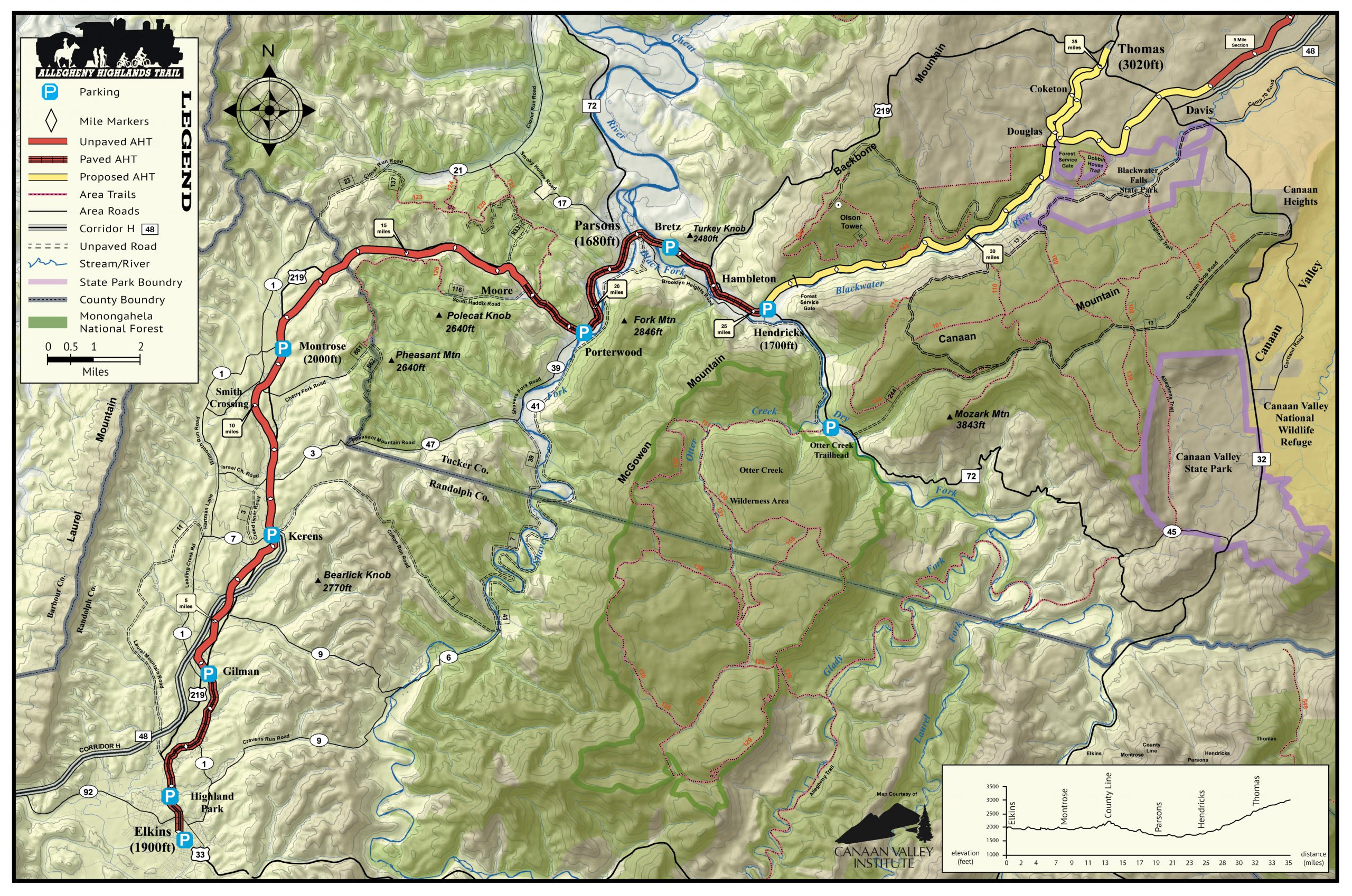
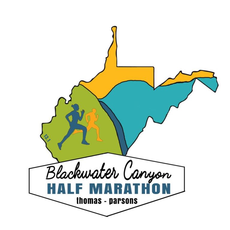
Blackwater Canyon Half Marathon
Saturday, September 11, 2021
See our Racepage for more details & to sign up!